Comparison of K-Means and K-Medoids Algorithms for Clustering of Potential Flood-Prone Areas in Bengkulu Province
01 Jun 2024
Geoinformatics
This research investigates the likelihood of flooding in Bengkulu Province, an area
prone to flood events. Key factors such as heavy rainfall, mountainous terrain, changes in land
use, insufficient drainage infrastructure, and the impact of climate change contribute
significantly to the occurrence of floods in this region. Utilizing Quantum GIS, this study
incorporates rainfall data and river distances from district centers to analyze the potential flood
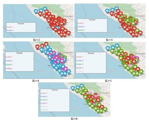
susceptibility of different areas. Employing clustering techniques, specifically K-means and Kmedoids, the research identifies areas at higher risk of flooding. The findings indicate that
employing K-means with five clusters yields superior outcomes, while K-medoids with two
clusters also provide valuable insights. By leveraging Geographic Information Systems (GIS),
flood-prone areas can be effectively mapped, enhancing the comprehension and mitigation of
flood risks. Recommendations stemming from this study include prioritizing common and
pertinent factors related to flood disasters, enhancing website user experience through UI/UX
enhancements, and improving online accessibility measures.